UNSW VIP · AI4Everyone

UNSW's
RoboCup
Rescue

We're building an AI-powered quadruped robot that navigates disaster zones, maps unknown environments, and identifies survivors — autonomously.

International Competition
RoboCup
Rescue
Autonomous search & rescue · Annual global contest

Search & rescue,
driven by AI

The RoboCup Rescue competition is an international robotics contest focused on developing robots capable of performing search and rescue operations in simulated disaster environments.

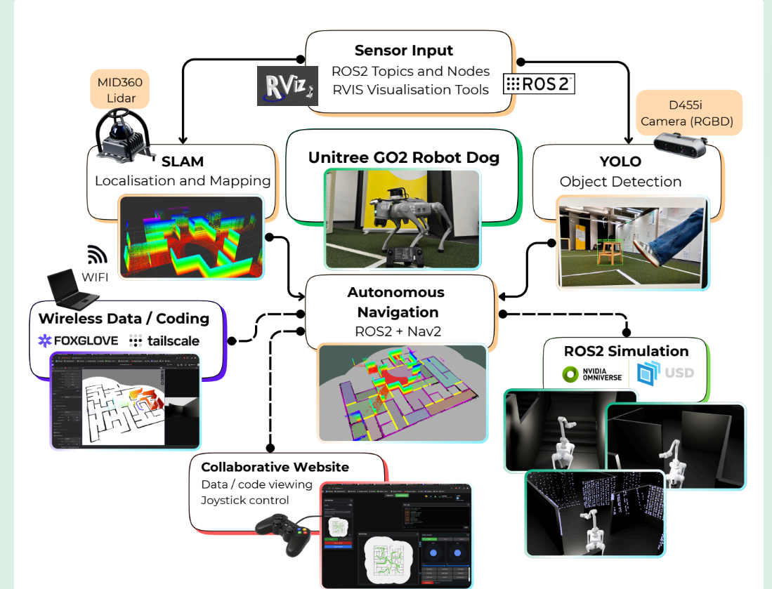
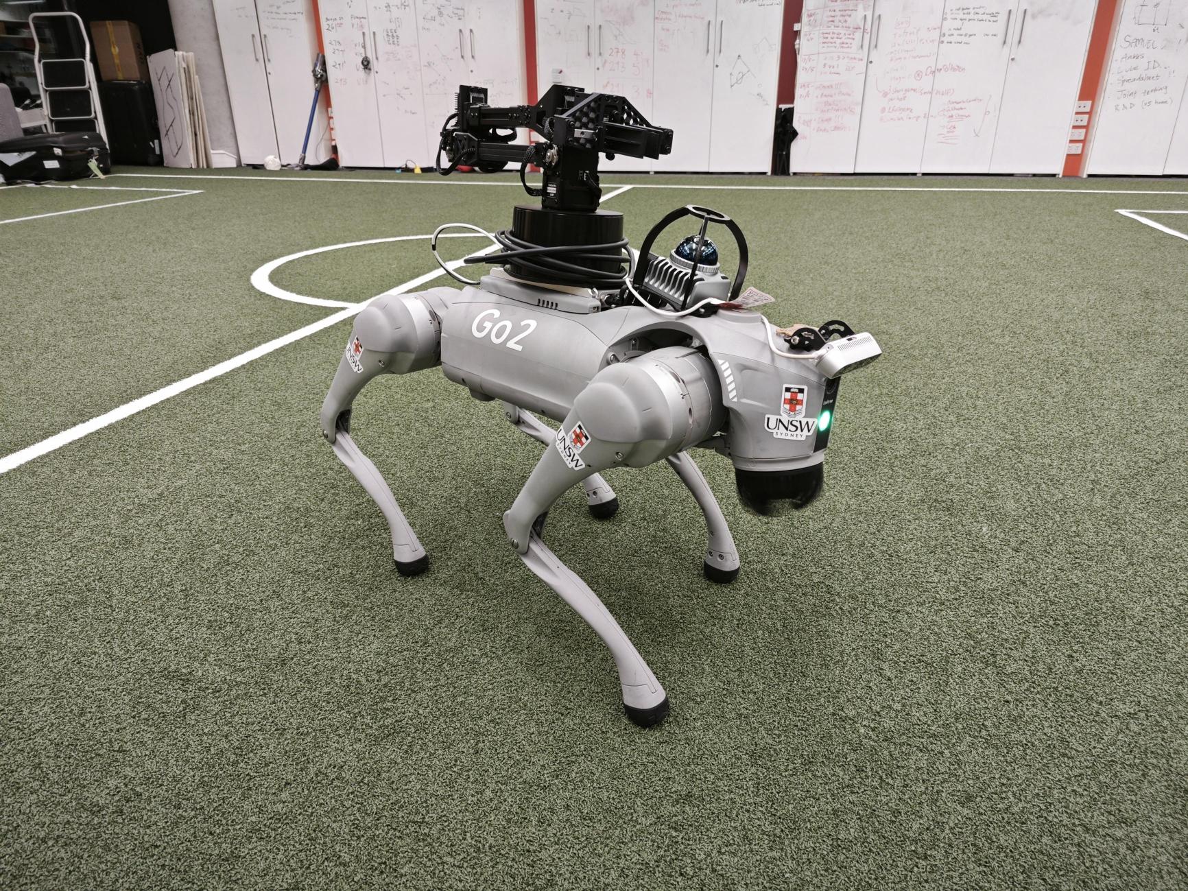
We equip a Unitree Go2 quadruped robot with advanced autonomous capabilities — environment exploration, victim identification, and real-time mapping — all running within the Robot Operating System (ROS 2).

Building on the efforts of previous teams, our goal is to create a highly competitive entry for the annual competition through sophisticated algorithms for SLAM, navigation, and computer vision.

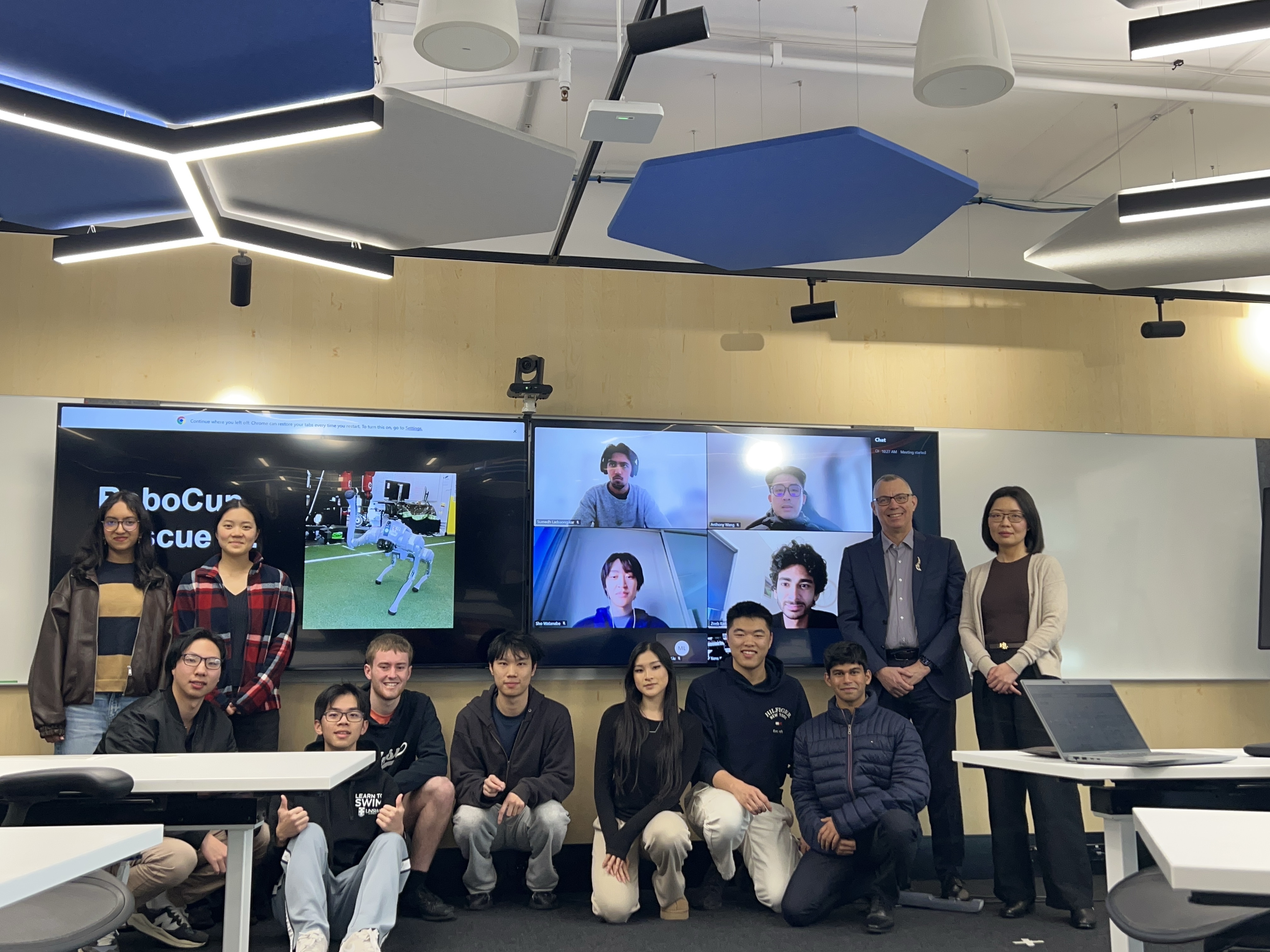
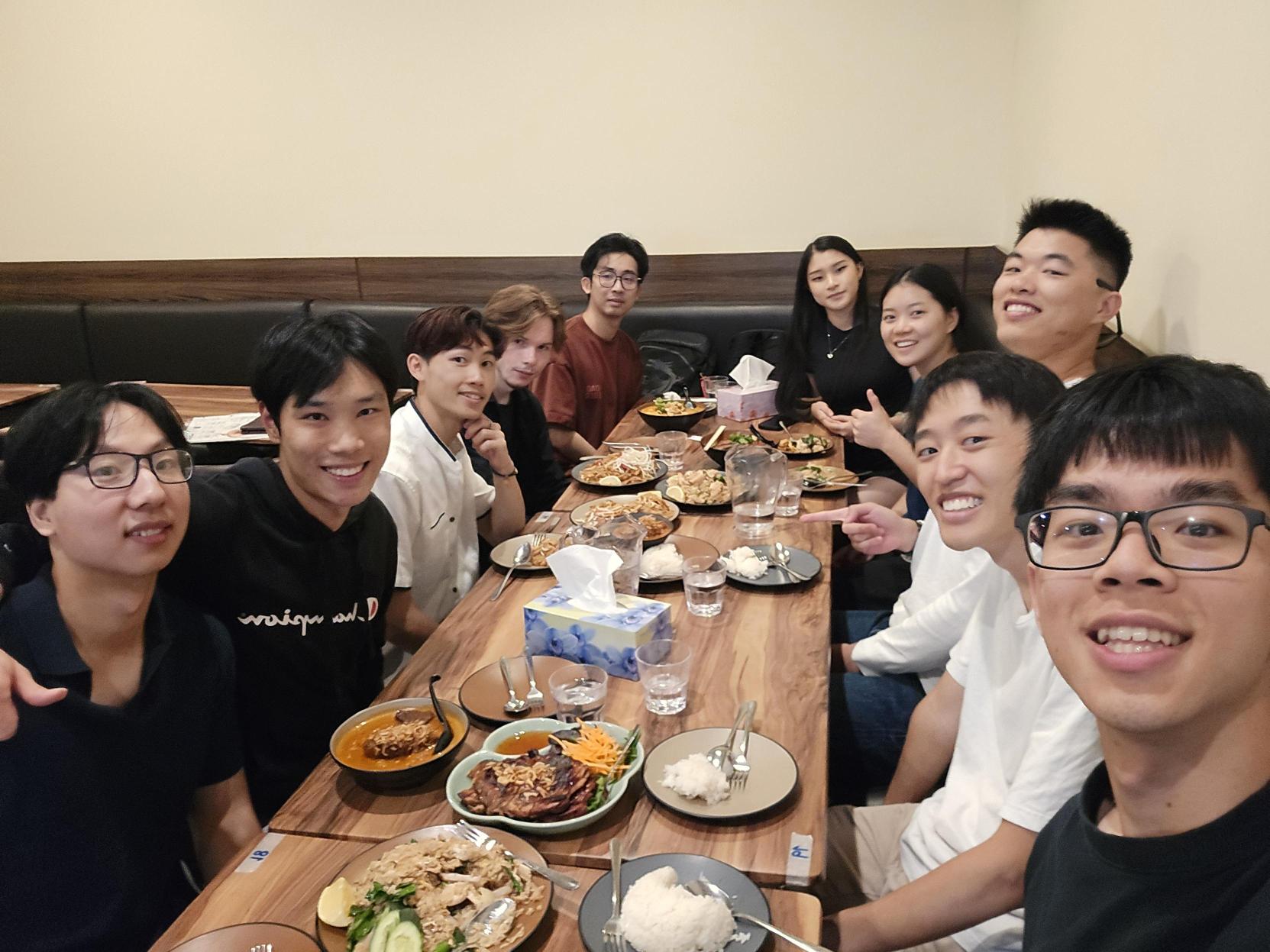
Team working on the robot
Robot Platform Unitree Go2 Quadruped
Framework Robot Operating System (ROS 2)
Program UNSW ChallENG — Vertically Integrated Projects
Team Members Victor Lim, Lukas Nielsen, Jet Lin, Julie Yang, Sam Gould, Tony Tang, Anthony Wang, Jodie Dsouza, Sho Watanabe, Zoeb Karim, Yuheng (Andy) Jian, Mindy Liu, Quanlin Wang, Siddharth Thathatripuram
Academic Leads Dr. Yang Song & Prof. Maurice Pagnucco
The technology stack

3D mapping and SLAM technology detail

01 · Mapping

3D Mapping & SLAM

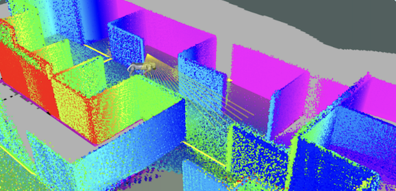
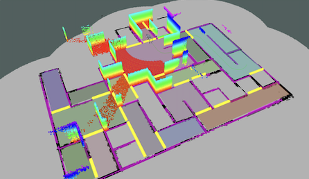
SLAM gives the robot a live understanding of where it is and what the environment looks like. The team works with LiDAR point clouds, map saving, coordinate transforms, and simulation pipelines so mapping can be tested before deployment on the Go2.

  • LiDAR point cloud processing
  • Real-time localisation
  • Map export for navigation
  • Simulation-to-hardware validation
Autonomous navigation technology detail

02 · Navigation

Autonomous Navigation

Navigation converts maps and mission goals into safe robot motion. This includes choosing reachable goals, planning paths around obstacles, recovering from blocked routes, and integrating movement commands with the quadruped control stack.

  • Nav2 path planning
  • Obstacle avoidance
  • Goal selection and recovery
  • Go2 movement integration
Computer vision technology detail

03 · Perception

Computer Vision

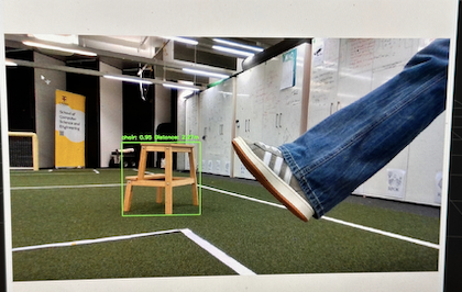
Computer vision helps the robot recognise rescue-relevant objects from camera and depth data. The goal is to detect victims, hazards, and visual landmarks reliably enough to support autonomous inspection and reporting.

  • Victim detection models
  • RGB-D camera streams
  • Hazard and landmark recognition
  • Hardware deployment pipeline
ROS architecture technology detail

04 · System

ROS Architecture

ROS keeps the project modular. Sensors, mapping, navigation, control, web monitoring, and development tools communicate through topics, services, actions, and launch files so each subsystem can be developed and tested independently.

  • ROS nodes and topics
  • Services and launch files
  • Container-based development
  • Monitoring and debugging tools
Sensor fusion technology detail

05 · Sensors

Sensor Fusion

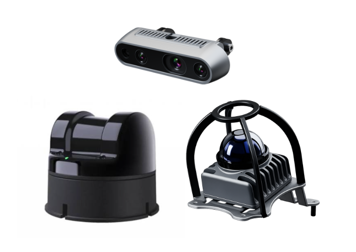
Sensor fusion combines LiDAR, IMU, camera, and depth information into a more stable estimate than any single sensor can provide. This improves mapping, localisation, and decision-making in cluttered rescue environments.

  • LiDAR and IMU alignment
  • Camera-depth integration
  • Robust state estimation
  • Low-latency data flow
Embodied AI technology detail

06 · Autonomy

Embodied AI

Decision-making coordinates the robot's exploration strategy. It connects perception, mapping, and navigation so the robot can decide where to inspect next, when to recover, and how to prioritise rescue-relevant discoveries.

  • Exploration strategy
  • Behaviour-tree style logic
  • Deep learning in computer vision
  • Reinforcement learning in walk

Road to
RoboCup 2027

By May 2026 Achieved

Foundations & Simulation

  • SLAM simulated efficiently using a single transformed point cloud
  • Nav2 Map Saver service integrated — exports PNG maps to the filesystem
  • Camera vision pipeline ready for deployment
  • Movement of the robot dog

By August 2026 In Progress

Hardware Integration

  • Run SLAM packages on mid360 LiDAR
  • Nav2 Navigation
  • Web controller for D1 arm
  • Implement basic autonomous manipulation behaviours with D1 arm
  • Train YOLO model with open source images for casualty detection

By End of 2026

Autonomy & Navigation

  • Implement basic dexterity with robotic arm
  • Integrate SLAM with navigation through NAV2
  • Integrate YOLO model with Realsense depth camera

RoboCup 2027

Competition

  • Field-ready autonomous rescue robot
Unitree Go2